Grave-by-Grave: The Volunteers GPS-Tagging America's Forgotten Cemeteries
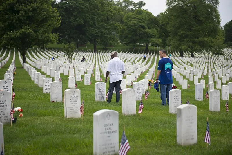
Photo: Arlington National Cemetery, Public domain, via Wikimedia Commons
On any given weekend, in a cemetery most people have never heard of, someone is kneeling in the grass with a phone in one hand and a scrub brush in the other. They are not there for a funeral. They are there for a name carved into stone in 1887, a date that might be wrong, and a distant cousin three states away who has been stuck on that branch for six years.
This is the volunteer cemetery documentation movement: ordinary people photographing headstones, transcribing inscriptions, and GPS-tagging grave sites so that family historians can find them online. It is slow, unglamorous, occasionally muddy work. It is also one of the most useful things happening in American genealogy right now.
The Saturday-Morning Archivists
The volunteers are not a single organized corps. They are retirees with pickup trucks, Scout troops earning badges, church groups, DAR chapters, veterans’ organizations, local historical societies, and lone genealogists who started with one family plot and kept going. Some carry professional cameras. Many use a smartphone and a free app. A few bring ladders, because obelisks are tall and inscriptions are not always at eye level.
In the RootsGather forums, you can watch the coordination happen in real time. A user posts a request for a photo of a stone in a rural county cemetery. Sometimes it sits for months. Sometimes a volunteer answers within twenty minutes because they live two towns over and were planning to mow the churchyard anyway. That is the strange magic of this hobby: a task that feels impossible from a laptop in Oregon becomes a forty-minute errand for a retired teacher in Kentucky.
Why the Map Has Holes
American cemetery records are not one database. They are thousands of little fiefdoms. Church cemeteries, family plots, municipal cemeteries, veterans’ cemeteries, fraternal cemeteries, and abandoned burial grounds all keep — or kept — their own records. Some are beautifully indexed. Some are in a shoebox. Some burned in a courthouse fire. Some were never written down at all.
That patchiness is why a national grave map can feel both enormous and weirdly empty. A big city cemetery may be fully photographed. A small family plot behind a cornfield may have no online presence at all. Rural areas, African American burial grounds, Native American sites, and cemeteries with predominantly immigrant communities are especially likely to be under-documented, for reasons that range from neglect to deliberate erasure to simple geography.
Then there is the physical world. Headstones sink. Limestone erodes. Vandals knock over markers. Ivy swallows whole rows. A cemetery that was legible in 1995 may be a thicket today. Volunteers are not just building an index; they are racing decay.
The Tools Are Cheap; the Labor Isn't
The technical side is almost laughably simple now. A smartphone can capture a photo, a GPS coordinate, and a transcription in one pass. Apps and platforms such as Find a Grave and BillionGraves have made it easier to upload that information. Local historical societies often maintain their own spreadsheets and PDF maps. The hard part is not the technology. It is the hours.
A single cemetery can take weeks. Volunteers photograph each stone, then go back and transcribe names and dates, checking for odd spellings and worn edges. They note plot locations, nearby family groupings, and military markers. They photograph the cemetery entrance, the sign, and sometimes the surrounding landscape so researchers can understand context. In older sections, they may find three people with the same name and no way to tell which one is which.
That is where forums become switchboards. A volunteer posts a question: “Does anyone know if the north section was re-lettered after the 1970s flood?” A local historian answers. Someone else uploads a plat map. A third person remembers that the church secretary kept a burial log in the fellowship hall. The work gets passed around like a casserole at a potluck.
What Distant Cousins Actually See
For researchers, the payoff is immediate and emotional. A photograph of a headstone can confirm a death date, reveal a maiden name, or show a family relationship that no census record made clear. It can also be the first time someone sees a physical trace of an ancestor who was previously just a name in a tree.
That matters more than it sounds. Genealogy is often described as a hunt for names, but the real hunt is for evidence that a person existed in a particular place at a particular time. A headstone is not a perfect source — dates can be wrong, names can be misspelled, and family lore can get carved into granite — but it is a physical document in a landscape. GPS-tagging it makes that document findable without a road trip.
In that sense, cemetery volunteers are heritage travel guides for people who cannot travel. They are mapping the places where family stories touch the ground.
Before You Grab a Camera
If you want to join in, start small and ask first. Contact the cemetery office, church, or caretaker if there is one. Respect posted hours and private property. Do not photograph people without permission. Be careful around unstable stones and avoid using harsh chemicals on fragile markers. Bring water, gloves, a soft brush, and a sense of humor about poison ivy.
Also, document what you document. Note the cemetery name, county, state, and the date of your visit. Photograph the stone before and after cleaning, if you clean at all. Transcribe exactly what you see, including abbreviations and odd spellings. If you cannot read a date, say so. Future researchers will thank you for your honesty more than for your guesswork.
The volunteer army is not going to finish mapping every grave in America anytime soon. But every weekend, somewhere, another row gets photographed, another name gets indexed, and another distant cousin gets unstuck. That is a pretty good way to spend a Saturday.